
Just as you think you’ve seen everything Norway has to show, it pulls another rabbit out of the hat!
Nobody came to turf us off our illicit camping spot overnight, in fact we were joined in our quasi trespass by two other vehicles. We were up and off unusually early for us, 10 am, which was fortunate because the day had plenty in store for us.
Our first stop was the small town of Lom, where we had to empty Basil and do a small shop. However overnight I had read that Lom was home to one of Norway’s famed Stave Churches, so we stopped there first. Stave Churches are entirely wooden structures named after the particular technique where the structure is supported by huge vertical timbers, known as staves. They are some of the oldest wooden buildings in the world.
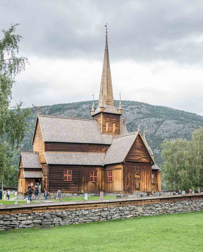
Lom Stave Church
The central section of the example in Lom was built in the late 12th Century and then extended in the 16th Century. On the outside of the church are carved dragons to ward off evil spirits, probably inherited from Viking culture. The interior is fairly plain, with little decoration, as might be expected from a Lutheran church, but much of the original joinery has been exposed showing an elaborately carved wooden structure, including some Runic inscriptions, probably from the original craftsmen.
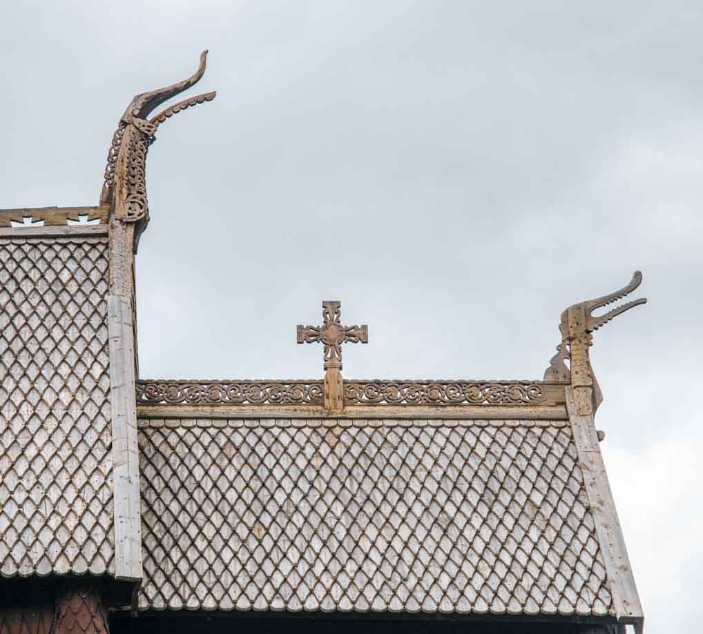
Lom Stave – Roof Detail
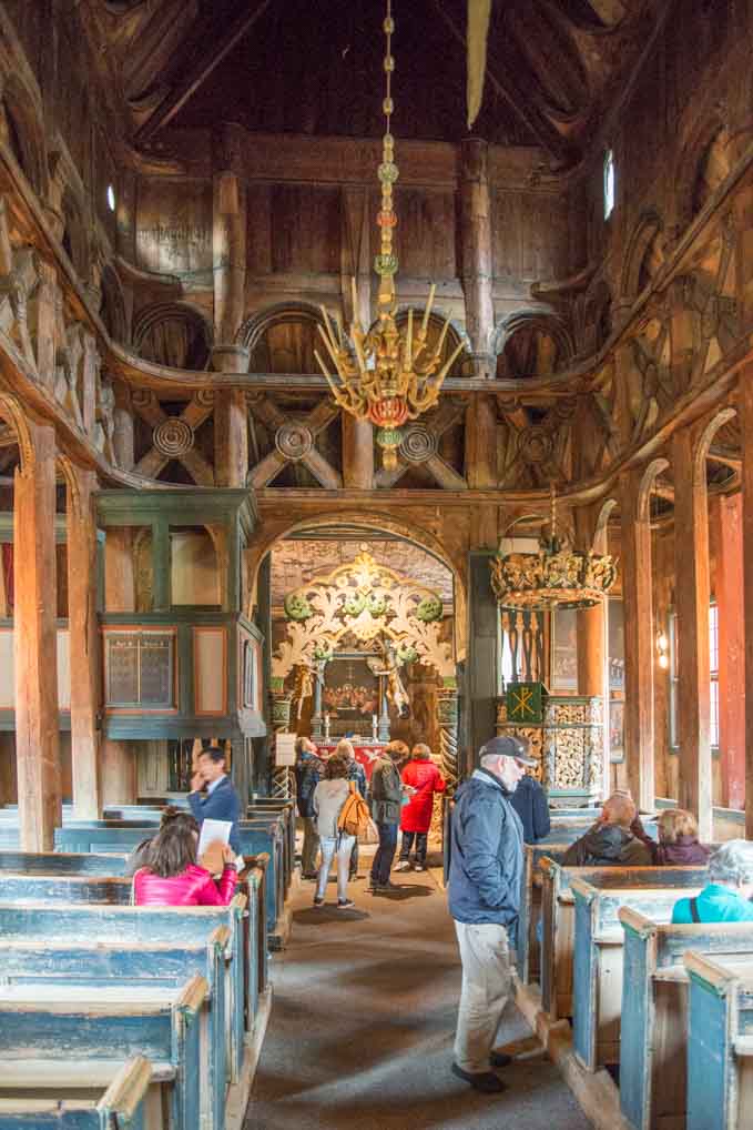
Lom Stave Church – Interior
The Lom church is entirely unique in my experience although is presumably similar to the other original stave churches in Norway and I believe Sweden. It provided an excellent start to the day.
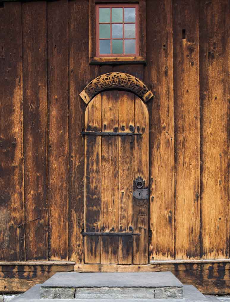
Lom Stave Church = Distressed Door!
Before we started our next Tourist Road a call at REMA 1000 was required. Friday is a grog day in Basil and so nothing more important than beer was required!
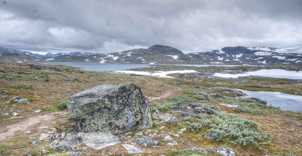
Our route for the day was the Sognefjellet Tourist Road, which has been called a road over the roof of Norway. It was built in the 1930s as a work programme for the unemployed and traverses the Jotunheimen National Park, the highest in Norway. It contains 60 glaciers and nearly 300 peaks over 2000 metres (6,500 feet), including northern Europe’s highest mountain at 2469 metres (8,100 feet).
View towards Sognefjellet
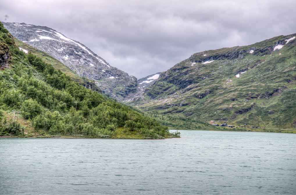
Sognefjellet
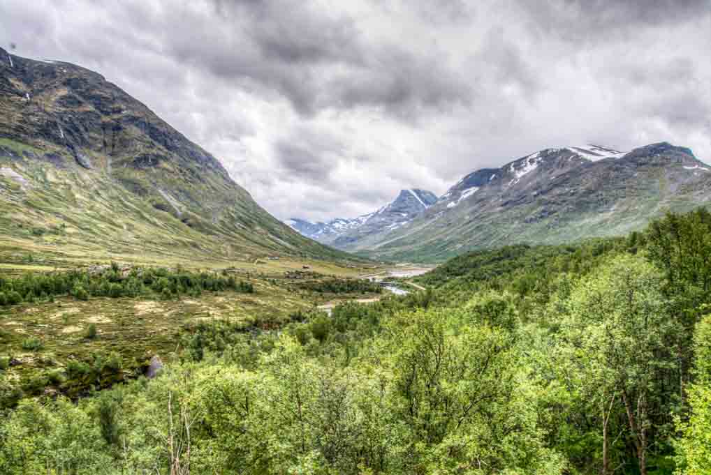
The road from Lom starts out deceptively gently, rises up a valley next to a river with an impressive series of rapids. Eventually you emerge from the pine and birch forests into a mountainous wilderness, where slabs of snow, some metres thick, still lie on the ground. Today’s weather was much better than yesterday, but the cloud base was still too low to allow us to see the highest peaks, but what we could see was still impressive.
Sognefjellet
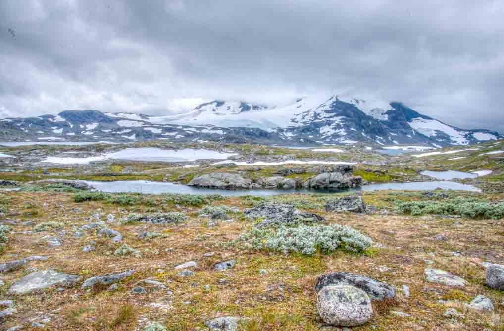
One of the interesting sights was that much of the lying snow was coloured pink, as if it had been sprayed with a bright children’s drink. I recalled hearing about red algae growing on snow and I am pretty sure that is what it was. We have certainly never seen this before.
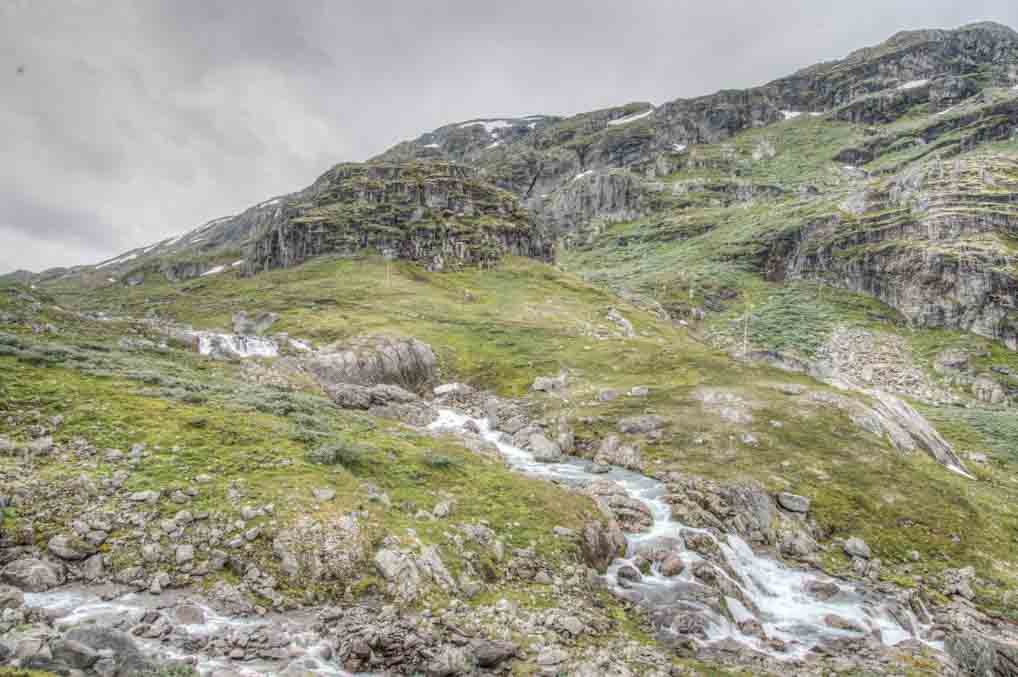
Sognefjellet
Lonely planet warns that even in summer hiking should not be undertaken lightly because snow can occur at any time of year. We stopped at various points to take photographs and admire the views. When we stopped for lunch at the highest point, about 1500 metres, we got out in the 7 degree temperature and with the bitter wind it reminded me of walks in the Yorkshire Dales and the Lake District in December and January!
Sognefjellet
Much of the route is single track road and so manoeuvring Basils’s bulk to the top and down was not simple. The descent was much steeper than the ascent, with numerous hairpin bends. At one point there was as distinct smell of burning from Basil’s front brakes, so we pulled over for 15 minutes and had a cup of tea while we let them cool before continuing.
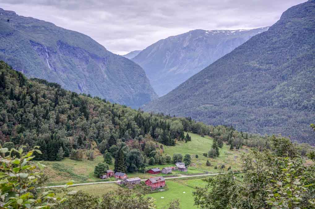
The final part of the day consisted of driving along the side of Norway’s longest fjord Storfjorden on a sometimes alarmingly narrow road, sandwiched between, on one side, a rock face and on the other a large concrete crash barrier. Basil had to pull in his stomach on many occasions to allow him to pass oncoming vehicles.
View towards Sognefjorden
Storfjorden again looks stunningly beautiful, but the weather did not allow it to be seen in all its glory. If it clears up tomorrow I think it could be the equal of Geirangerfjorden.
We are still ready to divert south if we wake up to find very low cloud or heavy rain. One of the two final Tourist Roads I have planned is a short road over high mountains and the other alongside the famous Hardangerfjorden. I think we can be happy with the mountains and fjords we have seen to date if we have to cut them out, but there is little point in spending time viewing sights which can’t be seen! Fingers crossed for tomorrow.
Our stop for the night (61.333363, 7.271250) is one of those places that you would never find without GPS and a database of wild camping spots. It is two miles off the main road, up a gravel track, in the forests above Storfjorden. We have already been joined by three other motorhomes, all inevitably intrepid Germans.